Our Services
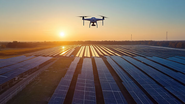
Solar Inspections
Identify performance issues and hotspots in solar panels with precision thermal imaging. Our drone-based solar inspections capture detailed thermal and visual data to detect panel defects, hotspots, or electrical faults early. This helps prevent energy loss and improves the overall efficiency of your solar systems.

Site Mapping & Surveys
Accurate aerial mapping for construction, land development, environmental analysis and industrial projects. We create high-resolution 2D maps and 3D models that provide real-world measurements and visual clarity for planning and analysis. Our mapping services help reduce manual surveying time while improving project accuracy.


Stockpile Calculations
Fast and accurate volume measurement for materials and stockpiles. Using drone photogrammetry, we calculate stockpile volumes with exceptional accuracy, eliminating the need for manual measurement. This saves time, enhances safety, and ensures precise reporting for construction and mining operations.
